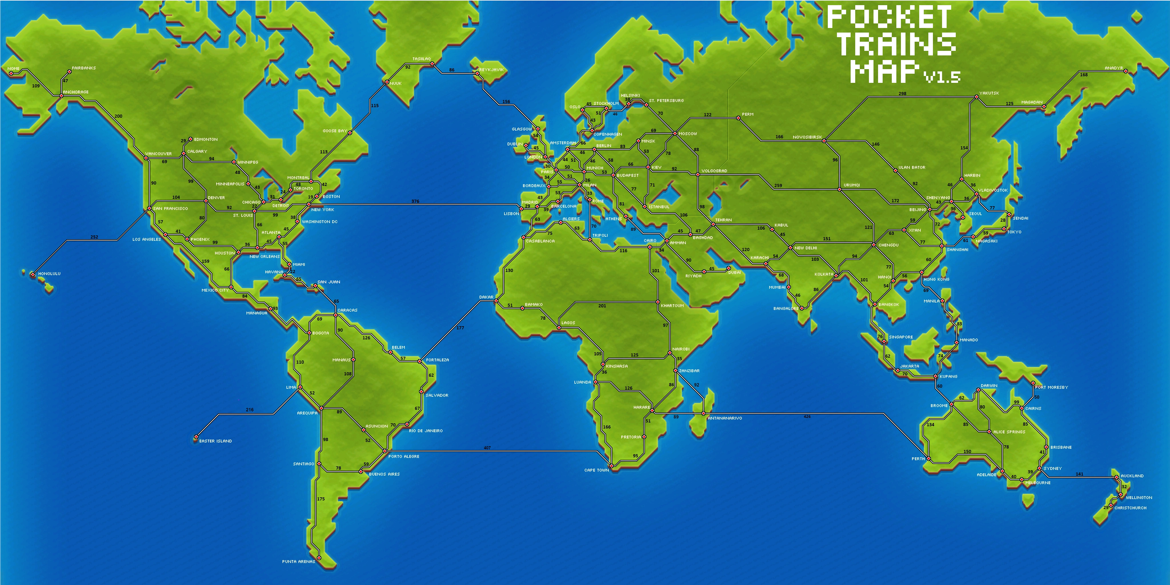
The Map is a recurring feature in Pocket Trains, first being implemented in 2011's Pocket Planes. The Pocket Trains and Planes map is a mercator projection, and is not contiguous, meaning tracks cannot cross to places, where on a globe, would be possible (eg. Honolulu-Tokyo). It can be used as a means of purchasing new tracks and stations, viewing the progress of a train as it travels to a destination, selecting the route of a train in the 'Jobs' screen, and just generally exploring the expansiveness of the game. A '+' icon is at the top left corner of the screen, being used to zoom in on the map. You can use this map to plan and design your railroads by regions. See the Help/Suggestions Page for further infomation. In the 2019 update, Antananarivo, Port Moresby, and Easter Island were added.
Trivia[]
- Because this map is a mercator projection, land forms at the poles look distorted. Greenland, as shown in this map, appears to be almost the size of Africa, when in reality it is approximately 13 times smaller.